18 August 2010

NotesVI

Wallowa Lake, Oregon, Spring 2009
©EOP

I am going to be out of the country until mid September, so this may be the last posting for awhile—do not know how much time to write or what kind of internet connexion I may have.

A correction of an error: several postings back I talked of el Niño conditions leading to more rain in the southwestern United States, a correct statement, but I also commented that there would be some refilling of Lake Mead and the other reservoirs on the Colorado. In fact, despite the rains, the drought has not broken, and Lake Mead has continued to loose water. Now the post el Niño condition called la Niña (a heresy for anyone who believes in Christian mythology, for el Niño means the Christ child and la Niña would mean the female equivalent!) promises yet more dry weather. Only slightly broken by the winter of 2010, the drought is the longest recorded for the southwest.

The post el Niño conditions projected for California and the southwest are dire, especially as there is evidence the period may also be warmer than normal. Higher rates of evapo-transpiration with warmer air temperatures increase the severity of the already serious drought. If it should continue several more years, there could be a real water supply crisis in the region including water for Los Angeles, Las Vegas and Phoenix.

Flood conditions in Pakistan are far worse than first described. The official death toll remains suspiciously low, but it has been estimated that 20 million have lost their homes and as much as a fifth of the country's land has suffered severe damage from the flood waters. The rains have not yet stopped, and thus the flooding could continue for some time. The displaced population is about the same as the total population of New York State, and the land area estimated to have suffered damage is greater than the land area of the Empire State! The area still covered by flood water and that damaged by high water includes some of the most productive farm land in Pakistan. Food production and the production of cotton and other crops are devastated for this growing season. Water borne disease has already been recorded, and it is not far fetched to worry about epidemic cholera, typhus, typhoid and possible malaria along with a variety of other gastro-intestinal problems. Large sums of money and other types of aid have been promised by various countries and international organisations, but much of that aid is likely to arrive too late to prevent one of the greater humanitarian catastrophes of recent years. The political dimensions can at present only be estimated, but it is hard to see how Pakistan's feeble civilian government will be able to cope.


Related articles by Zemanta
Enhanced by Zemanta

15 August 2010

Food: Some Preliminary Comments

Bicolor Sweet Corn, Fairfax City Farmers Market, 14 August 2010
©EOP
Since the beginning of summer, I  have devoted most of my available time to the fall term class on World Water Resources. Planning to leave the country in a few days, I realized that I need to give a little attention to the spring term course on World Food Resources, so I have been doing some thinking about what materials to include and how to organize the course. As with the water course, the prospect is a little daunting in the details. The subject is a big one, and it is full of fascinating bits of information, most of which cannot be featured in eight 90-minute sessions.

The single thing I find most fascinating, and troubling, about human food is how remarkably narrow human food choices are. Fewer than fifty species of plants and animals account for the vast majority of calories and other nutrients ingested by people, and an even smaller subset is dominant amongst those (rice, wheat, and maize amongst plant foods; cattle (including milk and milk products), chickens (including eggs) and pigs amongst animals). Humans do not consume as food the overwhelming number of the multiple millions of species of plants and animals. There are, of course, good reasons some species are not used: they are poisonous, they contain almost no nutrients in forms useful to people, they are extremely difficult to obtain, they are not amenable to agriculture, they are extremely difficult to process or to store, etc. With very few exceptions, those species used for food today have been used as food for the length of written history, and many of them can be traced by archaeologists to cultures living long before writing evolved. 

Over time a few things have become more or less common as foodstuffs, though much of that is explained by just two variables: the evolution of agriculture and the migration of people and species. The evolution of agriculture led to the displacement of  larger variety of foods gathered in the wild by that hand-full of species easier to propagate, notably grains and a few tree crops and animals that could be herded instead of a motley of wild species. Migration brought new world food species (for example potatoes and tomatoes) to the old world and vice versa. In those processes some foods once important, species of wild game for example, became inconsequential. Migration of species radically altered food production and consumption such that old world species dominate much of the agriculture of the U.S., though maize is crucially important, while national cuisines in the old world are linked to new world crops (potatoes and northern European countries, tomatoes in Italy).

The range of food indeed has become narrower over the past few generations. In much of the world beef has displaced other meat, and baked and yeast leavened wheat bread is becoming common in places like China where not long ago it was unknown. Maize, corn, has become a dominant grain in all kinds of food products including ones like sweet sodas where the sweetener is corn syrup.Along with soya (soy beans) corn has become a dominant crop in world agricultural trade. All of this needs to be examined in more detail as I work on the outline and lecture materials. These topics and lots of others!

13 August 2010

Notes VI

Heat Wave in the Indus Valley, June 2007

When I began preparing materials for use with the course on World Water Resources in the autumn, I copied a NASA space photograph of the Indus Valley (not the one above), encompassing Pakistan and large portions of its neighbors India and Afghanistan. Of necessity, India and especially Pakistan will be central topics in the course, but I did not anticipate the catastrophic flooding that has accompanied the summer monsoonal rains of 2010. Control of the waters of the Indus is one of the longest activities of civilization, for the residents of  Mohenjo-Daro and Harrapa, civilizations which flourished almost 5,000 years ago, used the Indus to irrigate their fields and feared its droughts and floods. The current flooding is but one season in an almost constant effort of people to make a livelihood from a beautiful but punishing environment.

Sumer Flooding in the Indus Valley, 3 August 2010


Meanwhile, rains have cooled Moscow somewhat, but peat fires remain a problem. This morning's New York Times has a good piece on peat fires. Along with an explanation of why those fires are so smoky, it also examines how a decision some years ago to drain bogs and mine the peat to use as fuel in electrical generating plants is partially to blame for the smoky fires, dangerous to health, of the extraordinarily hot summer of 2010.

Near the Potomac River, in Loudon County, VA a few kilometers northwest of the Fairfax County boundary, the real estate speculator Donald Trump is redeveloping a golf course. Today's Washington Post reported on the massive tree clearance on that roughly 325 hectare site. The spokesperson for Trump was quoted as saying "The trees threatened the shoreline. Many of the trees, ... stress and eroding (sic) the soil." I guess those trees are like the forest trees claimed by other public relations flacks to create air pollution and acid rain. Loudon County, and its neighbor Fairfax County should encourage widespread cutting of trees, deforestation, in order to protect the environment!

12 August 2010

Slurban Water Supplies: The Case of Kitsap County, Washington I

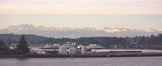
Eagle Harbor,  Bainbridge Island (née Winslow)
Kitsap County, Washington, Winter 2004
©EOP

When thinking about the problem of inadequate water supply for urban and slurban areas in the U.S., one usually thinks about the sprawling cities of the desert, probably including Albuquerque, Las Vegas and Phoenix. Even without climate change, those cities are likely to "run dry," that is outgrow feasible sources of inexpensive water, should growth resume after the Cheney-Bush economic crash. Only draconian restrictions on water use or immensely expensive new water projects will allow growth to continue at anything approaching the rate of the 1990-2005 period. One is not inclined to think of Seattle with its somewhat undeserved reputation for heavy rainfall (undeserved because Seattle actually receives less rain in a typical year than a number of East Coast and Midwest cities - Seatac Airport (SEA) receives about 930 mm of rain per year, while Washington National Airport (DCA) gets 1011 mm and St. Louis Airport (STL) gets 956 mm). In fact, in common with other U.S. cities in humid regions, Seattle, and especially some of its slurban territory, also faces problems of future water supply. This is especially true for those areas dependent on ground water, on aquifers, for a large part of that water.

The Kitsap Peninsula, a ferry ride from downtown Seattle on western side of Puget Sound, is a rapidly slurbanizing part of the Seattle metropolitan area. Despite its many cloudy days, Kitsap County (more or less coterminous with the Kitsap Peninsula plus Bainbridge Island) is facing potential water shortages over the next two decades. It grew from about 84,000 people in 1960 to about 240,000 in the fifty year period 1960-2010, by Sunbelt standards a moderate rate of growth. During that growth the county shifted from a mostly rural area with a small industrial city (Bremerton) to a largely slurban area. First to slurbanize was Bainbridge Island, a 35 minute ferry ride to downtown Searttle. A bit later, the expansion of military facilities, in particular the submarine base at Bangor on Hoods CanalNaval Base Kitsap, contributed to slurban development of the peninsular part of the county. Most recently lower prices for real estate in comparison to the eastern shore of Puget Sound, especially for parcels with shoreline access or views of water and mountains, attracted many to the county.

Seattle and other cities on the eastern shore of the Sound depend primarily on surface streams fed by melting Cascade snowpack for their water supplies. Even though there are high mountains with glaciers and heavy winter snows both east and west, the Kitsap Peninsula is separated by salt water from those mountains, and its water supply is mostly from ground water supplemented by a few surface streams. The costs of piping water to Kitsap County from the Olympics or the Cascades have been considered prohibitive in an area where cheap water is taken for granted.

Most of the Puget Sound Basin was glaciated in the last ice age, and the area was near the southern terminus of the great continental glaciers, the depositional zone for glacial detritus. In consequence, much of the surface is underlain by permeable sand and gravel forming an excellent aquifer.The West Coast of the coterminus U.S.  has a Mediterranean type climate with most precipitation falling in the months from October to April and a summer drought. Because there is ample winter precipitation in most years (unlike much of California where winter precipitation is uncertain), the Puget Sound aquifers store enough water to allow for summer growth of the lush evergreen forests which once blanketed the Peninsula. At moderate rates of usage, the aquifers also allow for agriculture with some supplemental irrigation and human settlements. Common to all aquifers, however, the rate of withdrawal can exceed the rate of recharge and cause the water level to drop.

Surrounded by salt water, some Puget Sound aquifers form lenses of fresh water floating atop denser salt water. When enough fresh water is withdrawn, salt water intrudes into those lenses. Beyond some critical level of withdrawal, the aquifer can be damaged or even destroyed for future use.The image below was drawn for the San Juan Islands, a little further north in Puget Sound, but the situation is almost identical on the Kitsap Peninsula (and as we shall see in a later posting, Bainbridge Island).


A not inconsiderable portion of the water supply of Kitsap County goes to service the large US Navy facilities in and near its largest place, Bremerton, and the submarine base at Keystone on Hoods Canal, the arm of Puget Sound that marks the county's western boundary. Together those facilities exert an industrial demand for process water, Bremerton is one of the U.S. Navy's more important shipyards, an export demand as ships heading out to sea are stocked with water, and a residential demand for military and civilian personnel working and living on the bases. Waste disposal, including unknown quantities of toxic chemicals,  from those facilities has contaminated some of the aquifer under the county.

The combination of contaminated aquifers, salt water intrusions, and the possibility of draining the aquifers by too much use define the limits of water use in Kitsap County, as they do everywhere that ground water is used as the major water source. In a future posting we shall examine the water use in the City of Bainbridge Island (coterminus with the island), the most densely developed slurb in the county.
Kitsap County (pink area Naval Bases), Bainbridge Island at the Center of the Map

11 August 2010

Trees, Dirt and Streams

Raw Dirt, Construction Site, George Mason University
Fairfax, VA, August 2010
©EOP

Yesterday afternoon, with the car thermometer registering 101 degrees F, I drove to the Vienna-Fairfax Metro station to pick up my wife. The area just south of the station looked radically different from its visage on my last trip to that station a few weeks earlier. A wooded area of several hectares had been stripped of all vegetation and was bare dirt being worked over by large construction machinery. It is the second property near the intersection of Route 29 and Nutley Street recently stripped of vegetation for new construction. In close proximity to the Metro Station, high density land uses are certainly justified, but was it necessary to clear away every last tree?

Fairfax County claims to be concerned about its tree cover, and has an ordinance to that end which, according to a news release from the County:

The Fairfax County Board of Supervisors adopted a tree preservation ordinance at its Oct. 15 (2007) meeting, protecting four types of trees. Under the new law, individual specimen, heritage, memorial or street trees can be protected from being cut down.
The new measure is not intended to protect large wooded tracts. Instead, the law only affects individual trees that property owners voluntarily agree to safeguard.
The board approved the law because even a single tree can benefit the environment. One mature tree with a 26-foot canopy can absorb the emissions of a vehicle driven 11,500 miles every year.
Homeowners, residents or groups can recommend individual trees for protection. After a public hearing, the board will approve the preservation of specific trees. Easements also may be required to protect a tree’s roots. If needed, property owners will donate the easements to the county.
As defined by the law, specimen trees are those that are notable in their size and quality for their species. Heritage trees have a historical or cultural interest. Memorial trees, as the name suggests, commemorate a memorial. Street trees are those that have been planted by the county on public rights of way.
There is a $2,500 fine for removing a protected tree without permission from the county. The ordinance takes effect immediately, and it has been added to the county code as chapter 120.
The preservation ordinance supports the county’s 30-Year Tree Canopy Goal adopted by the board in July. The county aims to blanket 45 percent of the county with tree cover by 2037. It is important to preserve existing trees because the county expects to lose 4 percent of its canopy during the next 30 years. To reach the goal, the county and the public also will have to plant an additional 2.6 million new trees.
Once achieved, the canopy goal is expected to save taxpayers money. The trees when matured should produce savings equivalent to $5.3 million for air pollution removal and $4.7 million in energy conservation every year. The additional canopy also will have the capacity to absorb more than 10 million pounds of carbon dioxide annually, which could eliminate the need for $1 million in greenhouse gas reduction services each year.
For more information about the new ordinance or 30-Year Tree Canopy Goal, call 703-324-1770, TTY 711, or visit www.fairfaxcounty.gov/dpwes/environmental/trees.htm.

It is interesting to note that the ordinance applies only to specific trees, not to forested areas. Since much of the woodland in the county is second growth, frequently a product of the reforestation of exhausted tobacco and other farm lands since the early and middle parts of the 20th century, that forest growing on nutrient poor land contains very few "specimen" trees notable for their age, girth, historical importance or beauty. Moreover, the ordinance only applies if land owners agree.

Fairfax City (under Virginia's peculiar local government system not a part of Fairfax County even though it is completely surrounded by it) calls itself a "Tree City USA." The City does indeed have many grand old trees and small woodlands, one of the strongest reasons attracting us to live here. Fairfax City has a stringent ordinance requiring City permission for tree removal. Despite that ordinance, a large parcel on the eastern edge of the City adjacent to Main Street (Route 236) was stripped of all vegetation for construction of residences just as the Cheney-Bush recession began in 2008, and the land has remained bare dirt since. As of a few weeks ago activity at the site has suggested that building will commence soon, but for about two years, through the melting snow of intense winter blizzards and torrential summer rainfall, dirt has eroded from that parcel into storm sewers flowing into nearby streams.

There has been a construction boom on the Fairfax campus of George Mason University over the past several years, and while some of that building used sites that previously had been parking lots, a major project at the north west corner of the campus, adjacent to Fairfax City, has also stripped several hectares of all vegetation. At the height of land, the site is the headwaters for a small stream which flows across the campus into a  holding pond. Despite some serious efforts to minimize erosion during construction, recent heavy rain has turned that pond a muddy brown, filling it with silt from the construction site a few hundred meters to its north. Eventually some of that silt will wash into the Occoquan, a primary source of water for the Virginia slurbs of Washington, DC.

Mason Pond, muddy after summer thunderstorms
George Mason University Campus, Fairfax
©EOP

Discussion of deforestation frequently focuses on the widespread cutting of trees in the Amazon Basin, in Brasil's Atlantic rain-forest, in Borneo or elsewhere in the tropics. In fact deforestation is a matter of consequence in many other areas. A recent Scientific American posting suggested that urban dwellers are driving deforestation. It was focusing on conditions in poorer countries where urban demand for food and fuel is leading to forest clearance, but the argument could well be extended to the United States where the demand for new slurban construction sites is causing large areas to be stripped of trees and other vegetation.

Fairfax City and County together have a large set of small-scale clearances which, in total, have a substantial impact on climate and water flow.The cooling effect of wooded land on nearby areas is well-known and easily demonstrated. On a hot and sunny summer day, walk from a copse of trees, even a small one, onto a patch of bare ground and the difference is instantly apparent. In a heat wave like the ones that have blighted the summer of 2010, a wooded area can be as much as 5 degrees C cooler than nearby open areas.

The effects of wooded land on water flow are a little more complicated. Forests even out the flow of streams, holding back some of it during and just after heavy rain and then releasing water in drier periods. The geology and soil of the Fairfax area and the torrential rains common with summer thunderstorms provide perfect conditions for filling streams with silt when the soil is bare.Wooded areas slow and filter the rapidly flowing rainwater draining after a storm, and they retain much of the material that could become silt. Water authorities in the county and nearby are well aware of the problems deforestation, and impermeable surfaces like paving  (a subject for another posting), create. Heavy rains in deforested areas lead to rapid runoff of silt loaded water into streams and reservoirs, while in a longish drought like the one in the first part of summer 2010, those streams and impoundments diminish or even dry up (their storage capacity getting smaller each storm as silt accumulates). When needed for water supply, that shrinkage can lead to sleepless nights for water managers after a long dry spell!

10 August 2010

Notes V


Several weeks ago I posted a piece on the Guaraní aquifer and commented on cooperation through Mercosur between the four South American states under which the vast underground deposit of water is found. On 2 August 2010 in the city of San Juan, Argentina (a pleasant city well outside the boundaries of the aquifer), Brasil, Paraguay, and Uruguay signed an agreement for use and management of that aquifer  (the website of the Brasilian Ministry of Foreign Affairs (Ministéio das Relaçoes Exteriores) posts the text of the agreement in Portuguese and Spanish). From an outsider's perspective, this is a remarkable achievement, for the agreement has been reached before there is any serious problem with the aquifer, and the agreement has been concluded between a set of states often at odds with each other, including open warfare in the 19th century and threats of war in the 20th. Whether the agreement is truly meaningful remains to be demonstrated, and at least one commentator has raised questions about its application once ratified.
Map of the Guaraní Aquifer

Those who, like an antediluvian and prehensile senator from the benighted state of Oklahoma (a state with what is apparently an early stone age Kultur), like to point to the hideous cold and snow of last winter as refutation of climate change, need to be corrected. A recent piece from Scientific American online should put their pseudo-argument to rest as it clearly demonstrates the cold and snow were evidence of short-term trends and not of any longer term phenomena. Climate change can never be shown by the events of a single season, and a period of colder than normal temperature with greater than normal snowfall in one season points to nothing in a long term pattern. The same can be said for the current hideously hot summer, though it is in line with the long-term trend for ever warmer summers in the Northern Hemisphere.

Smoke over Western Russia, 9 August 2010

A price of the smoke in Russia has been a substantial increase in illness and in the death rate in Moscow. Wildfires in agricultural areas, brush lands and desiccated forests are all but inevitable with climate change.
Enhanced by Zemanta

09 August 2010

Smoke, Trash and Dams

Three Gorges Dam, Yangtze River, China under construction below and nearly complete top

When it was proposed and during construction of the Three Gorges Dam, many commentators said it would fail to stem the floods for which the Yangtze is notorious. Since its completion the rains of summer 2010 mark the first season of precipitation greatly in excess of long-term averages, and events of the past two months would seem to prove their point. There has been substantial flooding both above and below the dam. Although the Chinese authorities claim the dam itself is sound,  it has been able to hold back only a small part of the additional flow of the massive river. Devastating flooding has wiped out towns and villages, farm fields, and transportation facilities both up and downstream from the world's largest barrage. Built for all four of the magic goals of dams, for the foreseeable future the Three Gorges Dam may fail at three of them, flood control, navigation, and hydroelectric generation, while the rains make the final one, irrigation, unnecessary.

Much of the detritus caused by the flooding, it turn, has washed into the river, and the dam has blocked that material coming from upstream in much the same way that it blocks silt in periods of normal flow. Upstream of the dam the accumulating trash in the reservoir, already about a meter thick and strong enough to form islands capable of supporting a person, could clog a floodgate and threaten the integrity of the dam itself, but more likely is blockage of the navigation locks (right hand side of the pictures) and fouling of the water flowing over and through the dam with trash that makes downstream use difficult. There are dire predictions about navigation dangers on the river, a crucial route for Chinese commerce, due to the accumulated trash. Upstream, the immense city of Chongqing (Chongqing (重庆; Chóngqìng formerly spelled Chungking), may have to draw water into its public supply that has been fouled by industrial and agricultural chemicals, farm waste, and human sewage. Rapid flow would serve to dilute those pollutants if the river had been left undammed, but the slack water behind dams results in far less mixing of waters and dilution of pollutants.

Meanwhile, at the opposite end of the rainfall spectrum, the severe drought and excessive heat that have plagued European Russia for most of the summer of 2010 have resulted in some serious problems of heat and smoke in the capital. Moscow, a city where air conditioning is rare because in the past it has been needed infrequently, has suffered multiple days with 35+ degrees Celsius. In addition to the heat, Muscovites are breathing air with dangerous levels of smoke, soot and other pollutants, a consequence of field, brush and forest fires, some of them burning down into the layers of peat beneath birch woods and brush lands surrounding the city. Peat, used as a fuel in several parts of the world, can smolder and burn for a long time once ignited, and until drenching rains or the winter cold begins, smoke will continue to plague Moscow even when temperatures moderate.

Most Russian grain is rain-fed with no supplemental irrigation, and the combination of drought and fires have devastated the 2010 crop. World grain prices have soared because analysts expect the grain crop in Russia to be far smaller than usual, and that country has banned grain exports. Increases in grain prices could spark serious food problems worldwide.Should the Argentinian and Australian grain areas suffer serious drought in the 2010-11 growing season, the year of 2011 could have a food crisis.


Temperature anomalies in Russia, Summer 2010

As always one must remember that the events of a single summer say nothing about climate change, but the flooding in Pakistan and China and the drought and heat in Russia are precisely the kinds of conditions that warmer earth temperatures point toward. Those include long spells of hot weather in many northern hemisphere cities, redistribution of precipitation with increases in some areas and deficits in others, and an increasing frequency of extreme weather events including both drought and torrential rainfall.
Enhanced by Zemanta

08 August 2010

Floods in Pakistan

4 August  2010

3 August 2009

 Flooding in North-Central Pakistan
Source: NASA Earth Observatory

Last week I published a brief posting on the weather extremes of 2010 and mentioned the catastrophic flooding in Pakistan. A couple of days ago one of my absolute favorite websites NASA Earth Observatory, from NASA Goddard Space Laboratory,  published a photograph of 2010 flood conditions in north-central Pakistan with a comparison to a more normal monsoonal wet season in 2009. Large areas of green are visible on both photos, the growing vegetation associated with the wet part of the monsoon as summer rains break the months-long winter dry spell.  The year 2009 was within normal rainfall expectations. There was some flooding of low lying areas, flooding anticipated annually, shown by the blue areas on the photographs. The difference in the amount of blue on the two photos gives an indication of the widespread flooding that has occurred as much heavier than normal monsoonal rain has fallen in the current rainy season.

The pulse of water from the rains is now pushing southward through the agricultural heartland of Pakistan toward Sindh. With advance warning, the loss of life in the south is likely to be small, but damage to roads, rail lines, towns and farms is inevitable. For presumably unrelated reasons the southern city of Karachi has recently suffered serious rioting. Economic displacements and flood refugees could make conditions in the already socially unstable city even more chaotic and difficult to control. 

Pakistan and India depend on monsoonal rains, the seasonal rainfall of mid and late summer, for virtually all of their rain-fed agriculture and much of the flow of major exotic rivers like the Indus and the Ganges. Years when monsoonal rains fail to arrive can portend great problems including the possibility of famine. A bitter irony is that excess rainfall can also cause great problems with many hundreds dead and vast damages to the agriculture and the economy. The current floods mark the second time in three years that excess rainfall has flooded large areas in Pakistan, for 2008 was also a year of flooding in the Indus Valley.

For anyone with an interest in the issue of flooding and drought in India and Pakistan, or water issues more generally, the NASA Earth Observatory site is strongly recommended both for its stunning photography (and mapping) from space data and also for its simple and clear explanations of the phenomena shown in the photographs. The current photograph of the day shows a failure of the Tempe, AZ town drain, a way of removing excess water in the occasional monsoonal flooding in the Arizona desert slurb. The southwestern United States and adjacent portions of México share with southern Asia a monsoonal climate!
Enhanced by Zemanta

07 August 2010

Minerals, Mining, and Water II: Hydraulic Gold Mining in California


"Hydraulic Mining, Behind the Pipes." 

Several months ago I purchased a copy of Isenberg, Andrew. 2006. Mining California: An Ecological History (New York: Hill & Wang, ISBN 0-8090-6932-6) at a used book sale. I have an ongoing if rarely pursued interest in the history of the far western US and in mining as a part of that history. Over the past few very hot days, stuck at home waiting for plumbers, I have been reading the fine and fascinating book. The early history of California is intimately tied to mining, and more than 100 years after the last hydraulic mines closed, scars remain on the landscapes of the Sierra Nevada foothills in "Gold Rush Country." Hydraulic mining techniques were widely used after about 1855, as water at high pressure was sent through nozzles pointed at loose sediments known or expected to contain gold nodules. The resulting mud was then run through screens and placers which separated out the valueless sand and gravel and left behind much of the heavier gold and other valuable minerals. (Not all of the gold was recovered, and there is a small but thriving present day business reprocessing the sand and gravel to recover the precious metals early mining left behind in deposits of sand and gravel like the one shown in th photo at the end of this posting).

In order to feed the high pressure nozzles, a great deal of water was needed, and to assure pressures high enough to wash the loose sediments into sluices, dams and aqueducts were built higher up on the streams. Not a few of those dams were poorly engineered or shoddily constructed, and there were several catastrophic dam breaks flooding downstream areas and killing miners unlucky enough to be in the path of the water flowing downhill. Vast quantities of materials were displaced by the technique, and among several consequences rivers once running clear were turned into thin mud flows. Salmon runs in those rivers ended, and San Francisco Bay received large quantities of silt. The already flood prone Sacramento and San Joaquin Rivers, near sea level in their final kilometers where they meet in the delta, flooded more often and more catastrophically. Closer to the mines, towns had to find alternate water sources as the water was too muddy and contained toxic metals dissolved at and downstream from the workings. Hydraulic mining was finally banned in 1884 by a decision of the federal 9th Circuit Court.

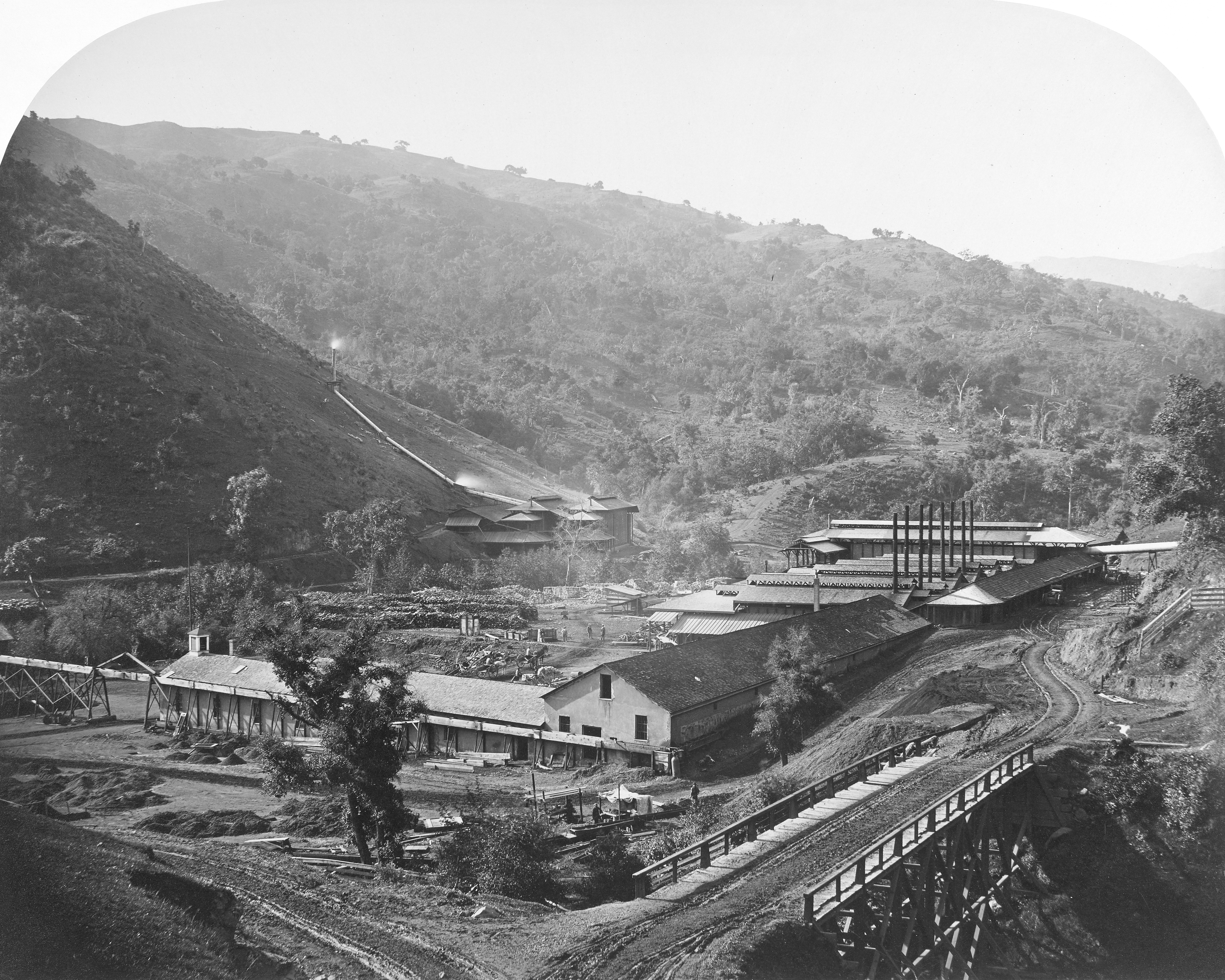
Traces of mining history remain in the water supply of those streams where water melted from the Sierra Nevada snowpack and flowing through the rivers of the gold region was used in hydraulic mining and today is the water supply for much of California's 37 million people, its industry, and its agriculture. Gold and other precious metals were the magnets attracting miners to the state, but California was also one of the world's major producers of mercury, chemical symbol Hg, at the New Almaden mine in the Coast Range mountains near present day San José in Santa Clara County and at New Idria in San Benito County about 100 km south. Mercury in most of its common forms is toxic to humans, domestic animals, and much plant life, and in some forms only a small exposure to mercury is needed to have toxic effect.
New Almaden Smelting Works, 1863
Source: Wikipedia

The proximity of the mercury source, it is less than 500 km between the New Almaden mine and most of the gold workings in the Sierra foothills, made an amalgamation process of mining popular. Gold (as well as silver and several other valuable metals) will dissolve in mercury. Once a quantity of ore is dissolved in a flask of mercury, distillation drives off the mercury, which can then be condensed and reused, leaving behind the desired gold. While the mercury fumes were highly toxic to anyone who happened to breathe them during the distillation, the process was inexpensive and thus popular. It was far from perfect, and lumps of mercury contaminated material were deposited in the detritus of hydraulic (and other) mines. Over time some of that mercury has leeched into the flowing waters of streams and contaminates nearby rivers. Occasionally health authorities ban use of the water for domestic purposes because of mercury contamination. In California with perennial water supply problems, mercury contamination of some of its more reliable streams remains a serious and ongoing problem.

Cone of hydraulic tailings on Wedge Gulch, The tailings were partly caught by a restraining dam, and the mass afterward eroded when the dam gave out. Big Trees quadrangle, Calaveras County, California. 1905. Published as plate 5-A in U.S. Geological Survey. Professional paper 105, 1917.
Enhanced by Zemanta

05 August 2010

Petroleum, Pipelines and Water

Whittier Oil field, wells along property line of Central Oil company and Murphy Oil company. Looking east. Los Angeles County, California. 1905. Plate 13-A in U.S. Geological Survey. Bulletin 309. 1907.

My expectations of more oil flooding out of the breech in the Gulf seem to have been misplaced, and the ongoing process of sealing the well ("static kill" in the lingo of the trade) seems to be working. Moreover, we are told by the EPA that a large fraction of the oil that gushed from the breech has now dissipated. I hope the EPA statement is true, but I fear in the not too distant future oceanographers of various stripes will find it to have been an over rosy evaluation of what future environmental historians are likely to describe as one of the greatest ecological catastrophes since the beginning of the industrial revolution. Anyway, the effects of  the BP spill on fresh water were minimal, and its effects on food supply through the contamination of one of the most important source areas for seafood should be clearer before the food course begins in the Spring.

Petroleum is not out of the water supply picture, however, nor is it likely to be until the age of petroleum ends. A pipeline leak in Michigan has contaminated the Kalamazoo River, a stream flowing into Lake Michigan, the primary water source for Chicago, Milwaukee, and many smaller communities. The Enbridge Spill, named after the pipeline company operating the breeched pipe, has been estimated to have dumped more than 3,755,00 liters (1 million gallons) of crude oil  into the river, causing some nearby residents to be evacuated and restrictions to be placed on the use of the river for water supply and recreation. It is lucky that no nearby large town uses the river as its major source of water!

Enbridge Michigan Pipeline and Spill Location

The Enbridge spill has not, as far as we know, killed or even seriously injured anyone. In 1999 a rupture in a gasoline pipeline sent that flammable liquid downstream in Whatcom Creek in the city of Bellingham, Washington. Three youths were killed, two of them while playing with the matches that ignited an immense explosion. The third victim was a recent high school graduate celebrating the arrival of warm weather with a afternoon of fly fishing downstream from the Olympic Pipeline spill at Whatcom Falls Park, probably killed by the fumes before his body was incinerated by the fire. Whatcom Creek flows, partially underground, near the center of Bellingham enroute to Puget Sound. Gasoline entered the city's sewers, and there was a realistic fear that much of the picturesque center of Bellingham would explode in a huge fireball. A number of structures in Bellingham were damaged, and the pumping plant at a sewage treatment facility on Whatcom Creek was all but completely destroyed. Indeed the Bellingham area, often ranked as one of the most desirable places to live in the United States, has an unfortunate relationship to oil and oil pipelines. Earlier this year 7 workers were killed in an explosion at an oil refinery about 50 km away, and since the events of 1999 the city has been on edge each time a spill has been reported, including a large underground one in 2007. Facing one of the most beautiful but also one of the most heavily utilized portions of Puget Sound, the city is also acutely aware of the possibility of a maritime accident, including one in Canadian waters less than 100 km distant, though a May 2010 article in the major Vancouver, BC newspaper thinks tanker leakage is unlikely.

View of smoke from Whatcom Falls Gasoline Spill, 1999

The old axiom that oil and water do not mix has considerable resonance in any discussion of water supplies. Neither the Gulf nor the Bellingham spills directly impacted on the supply of fresh water, though the Bellingham spill and subsequent explosion and fire did destroy a sewage treatment facility. It seems only a matter of time until an oil pipeline passing across a stream breaks and renders the stream unfit for use in the water system of some large city or another. A break in a pipeline or other large spill involving the Ohio or the Mississippi could render water from those rivers unfit for consumption for hundreds of miles and would all but inevitably affect a large city.

[At home we are suffering a water supply problem! A leaking hot water tank and a malfunctioning shut off valve for that tank means the water to the house is shut off until the plumber can fix it later in the day. Hardly equivalent to even a tiny part of the suffering of that fifth or more of humanity who lack access to adequate water, but it does generate more sympathy for them.]

03 August 2010

Droughts and Floods


Navy Memorial Fountain, Pennsylvania Avenue NW, Washington, DC 2010
©EOP

Todays feed from Huffington Post includes a rather apocalyptic piece by Toby Barlow "Let's Call it Climate Chaos." I have enough experience with both climatology and statistics to realize that the current nexus of climate related issues worldwide is in itself neither proof nor disproof of climate change—only trends over a longer period can serve that purpose—but current conditions give powerful reasons to fret about the future of a warmer world. Those of us unfortunate enough to live in the Mid-Atlantic states have experienced a prolonged spell of very hot and uncomfortable weather, though neither New York nor Washington, DC actually set new records for the month of July, merely matching older ones. Just the discomfort of hotter summers is adequate to make one hope global warming is limited to only a few degrees at most. It is clear that warming has many effects, most of them much scarier than simple discomfort.


Much of European Russia has had one of its hottest and driest summers ever. It seems that Moscow is posting new heat records almost daily even as its residents are forced to breathe smoke filled air from countless brush, field, and forest fires in the surrounding region. In addition to the dessicating heat, rainfall in the breadbasket areas south of Moscow are far below long term norms with some areas receiving only a tiny fraction of the precipitation expected. Grain yields are in turn now expected to be well below long-term averages, and it will soon be too late, if it is not already, for additional rainfall to benefit the current year's crop. The expected deficit in grain production is likely to raise world grain prices, for it has already raised grain futures.

The drought in Russia points to the changes in the global distribution of precipitation during a hotter Northern Hemisphere summer. The summer of 2010 is entrain to be the hottest ever recorded (just as the 2009-10 winter was the warmest recorded). Common to post el Niño seasons, the southwestern United States, including Southern California and the lower Colorado River Basin has enjoyed above average rainfall, somewhat breaking the years long drought. That has started to refill the various reservoirs, though it is unlikely to leave Lake Mead, Lake Powell or the others anything close to bank-full. For the moment at least, a drought has been broken in an area where water supplies are historically very limited.

In Asia excess rainfall is the issue with deadly flooding in both Pakistan and China. Pakistanis wish for rain in the wet part of the monsoon in mid to late summer, but this year has brought rainfall far in excess of long term averages, and 1,000 or more people have been killed by flood-related causes even as bridges, roads, and rail lines have been severed, towns destroyed, and agricultural areas devastated as rushing waters was away topsoil and growing crops. Instead of providing needed water for crops, the monsoonal rainfall of 2010 has caused massive damage. The situation in southern China is similar to that in Pakistan, though it is a function of typhoon circulation rather than the Asian Monsoon. 

The combined effects of these weather conditions, especially droughts and flooding, could have substantial impact on food prices throughout the world. European Russia and southern China export food to other parts of those countries and to world markets. Pakistan is a net food importer, and destruction of good agricultural land is likely to lead to greater demands for imported food. The combination of reduced production and demand from those areas made unproductive by drought and flood is almost certain to led to increased prices for at least some commodities. Those price increases are already apparent in world agricultural markets.

Once again it is important to note that the current summer is not in itself evidence for climate change, but it offers us a shocking preview of what warmer global temperatures portend. From the point of view of water supplies, a massive global redistribution of precipitation will be making some areas much drier than they have been in the past while other areas suffer from excessive precipitation. Severe storms are likely to become much more common, and 100-year floods may become 10-year floods. Instead of being expected not more than once in a century, those water levels will be expected once a decade. Some presently habitable areas will be erased from the map by flooding (granted other areas currently uninhabitable may be added to the ecumene but a net loss of usable land is the most likely outcome), while others will become too dry to use for crops. The world's food supplies are likely to be reduced and food prices increased by the combined effects of drought, flooding, and loss of land accompanying an increase in average world temperatures. It is all quite scary to contemplate!

1880-2009 global mean surface temperature diff...Image via Wikipedia

Enhanced by Zemanta

02 August 2010

Bottled Water II: The Baltimore-Washington Area

Infrared photographs of zone between Baltimore and Washington, DC 1973 and 2002 showing increase in urban development. Source: NASA Earth Observatory

Awhile ago I posted some comments on bottled water. When thinking about bottled water, we mostly think of the small bottles people who jog, bicycle, or want to appear addicted to exercise carry with them along with the multi-liter bottles on the refrigerator shelf. According to a television advertisement for Britta philtres, people in the United States annually empty enough of those bottles to encircle the earth 100 times. The costs in monetary terms and in environmental damage from consumption of that kind of bottled water are substantial, a topic we may examine in a little more detail at some later date.

Another kind of bottled water is known to people in urban areas where large (and mostly reusable) jugs of water are delivered to office and shop water coolers. That business, like the sale of smaller bottles, is huge as evidenced by a fawning piece in the pathetic business section of todays right-wing Washington Post (WP). The Washington-Baltimore metropolitan area is supplied by an oligopoly composed of two multi-national firms Crystal Springs and the Nestle owned Deer Park along with a much smaller local firm DrinkMore Water (also peddling small bottles with custom labels through its division called DrinkMore Custom Water). Those firms will deliver to private residences, but the bulk of their sales are to large customers in offices, retail establishments, and factories. The evidence in the piece published today by the WP is the market is growing.

The reasoning for having water delivered rather than using tap water for employee and customer drinking is complicated, but a simple analysis would suggest that it is almost never justified. By any measure, bottled water, even that in large jugs, is far costlier than water from the tap. Instead of fractions of a penny per liter, the bottled water costs 10 cents or more per liter, often substantially more. The cost is quite variable depending on how much water is delivered to a given location. For home delivered water at $7.50 per 19 liter container (5 gallons) advertised by DrinkMore Water in the DC area, the bottled water  is about 40 cents per liter. Fairfax Water tap water costs its residential customers between $1.94 and $2.08 for 3,785 liters (1,000 gallons) or about 0.55 cents per liter at the county water agency's highest rate.

The water delivered by the oligopolistic companies is generally safe water, at or below maximum acceptable levels of bacteria and other contaminants, but the water delivered by urban water supply systems through the taps also meets that requirement. The Environmental Protection Agency (EPA) has established maximum allowable levels for various contaminants, and it requires frequent testing of water by suppliers to ensure water is not contaminated beyond those levels. Advertising to the contrary, it is not at all clear that bottled water is any healthier or safer to drink than tap water, except in a very few special circumstances when local tap water is contaminated. In the end, taste is the primary selling point, and the companies argue their water has a better taste because of special filtration.

Recent postings have noted water supply issues in the Maryland area served by Washington Suburban Sanitary Commission. At the moment there are no restrictions or advisories, but ones in the recent past have been alarming. In the District of Columbia, lead in the water remains an issue and will until a vast investment is made in replacement of aging pipes, though the use of orthophosphate and other treatment has reduced the levels of lead in almost all of the water to the EPA maximum or less. The District of Columbia Water and Sewer Authority offers lead testing for concerned customers with lead problems frequently occurring within private structures and not in the public water mains. The water in Fairfax County, Virginia the largest suburban jurisdiction, tastes foul to many of us, but it meets or exceeds EPA standards, and the foul taste can be removed using simple filters like those sold by Britta. Despite those reservations, all of the evidence suggests that there is really little reason for the vast majority of commercial sites in the Washington-Baltimore metropolitan area to depend on delivered bottled water. In addition to the monetary costs noted above, each of those oligopolistic companies selling bottled water has a fleet of trucks driving many kilometers each day in order to serve customers scattered over several thousand square kilometers of territory and contributes to environmental contamination in several other ways as well.
Enhanced by Zemanta